


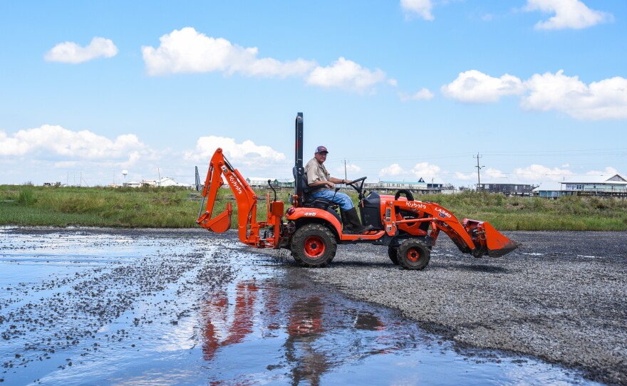
Outside the local levees and floodgates, nearly 8 feet of storm surge swept across part of the community of Cocodrie as Hurricane Francine passed last week. When the water receded, piles of mud and debris covered the parking lot and lower levels of the state’s premier coastal research center.
The loud hum of pressure washers could be heard as staff — also caked with mud — scraped the concrete floors with wide push brooms.
Elevated 19 feet in the air, the Louisiana Universities Marine Consortium, or LUMCON, was designed to survive floodwaters. Founded in 1979, the center has outlasted more than a dozen hurricanes, and Brian Roberts, LUMCON’s executive director and chief scientist, said the staff has learned how to clean up the aftermath. The mud is just the first step.
“We try to get to the most sensitive areas as quickly as we can with the mud,” he said. “That's why we've got people here today.”

But Francine did more than leave behind inches of mud. Several docks were damaged or swept away completely. A small trailer was overturned. Thick, metal doors designed to withstand hurricane-force winds were knocked off their hinges, flooding the room inside.
“These are hurricane doors, but hurricane winds are different than hurricane water,” Roberts said. He gestured at the jumbled mess of heavy, metal equipment, once secured in place.
“Obviously, all this stuff is not where it's supposed to be.”
Much of that damage will take longer to repair.
Aside from being elevated, the research center has several other protections to make it resilient against the threats of being where Louisiana marsh meets the sea. Hurricane shutters over thick glass windows protected the building from debris sent flying by Francine’s 96-mile-per-hour winds.


But as the number of stronger hurricanes increases and sea levels rise, it’s unclear how long the facility will be operable — or accessible.
Even without a storm like Francine, Roberts said the facility’s parking lot, and the road itself, can become submerged during high tide with a strong wind from the south. This summer, Roberts had to evacuate staff at 4 a.m. because the tide was so high. Within a few hours, the highway leading to the facility was submerged under a foot-and-a-half of water.
The more the land around the facility sinks, the marsh erodes and the global sea levels rise, the more flooding will occur at the center. Roberts said their team documents each time their staff is affected by “sunny day flooding,” or high tide flooding, on top of storms. Trudging through a flooded parking lot has become par for the course.
“Most people carry their shrimp boots in their trunks because of that,” Roberts said.
The parking lot flooding is a nuisance, but he said the benefits of the center’s location at the edge of the Gulf still outweighs any inconvenience.

“This is the sea level rise that we're experiencing is happening at a faster rate than most places in the world,” Roberts said. “But this is something that all coastal communities in the world are going to be dealing with in the future.”
Researching the changes in real-time at “ground zero” means researchers have the chance to come up with new adaptations and ways to sustain communities in the face of a changing coast, he said.
“We’re truly a living laboratory,” he said.
Their location allows them to research land loss, oil spills, the Gulf of Mexico and marsh systems in a way that would be more difficult if it was based farther inland.
Past LUMCON staff say that has always been a key opportunity for the center, so they tried to make sure it would last. Don Boesch served as executive director for a decade when LUMCON was first built in the 1980s.


He said the architects drilled pilings deeper into the soft mud beneath the building to make sure it wouldn’t sink into the marsh. The height of the building was also critical.
“It’s been almost 40 years so it’s served its purpose,” Boesch said. The hurricane shutters were a relatively new addition, not part of the original design. Boesch said Hurricane Andrew taught them that lesson in 1992 when the wind turned gravel into tiny bullets, smashing the fortified windows. Now, LUMCON staff also have access to a second facility in Houma where they can dock their research vessels.
At this point, Boesch and Roberts said it’s not the building that’s in jeopardy, it’s access. The single highway leading to the fishing village is the only way in or out. When it floods, staff have no way to reach the center, and the community can’t access their homes.
In 2020, the parking lot flooded 51 times and the road was submerged 14 times. Elevating the road isn’t in Robert’s control. If water swallows the area surrounding the center, it’s game over.
“We're gonna try to stay here as long as we can because it is a great research and education opportunity by having this facility down in Cocodrie," Roberts said.
He said they’re working with the community, local marinas and the oil and gas industry to advocate for the high cost of maintaining and elevating the highway.
If the roads leading to LUMCON are elevated, he said the center, and the rest of the community, could exist for several decades. Without it, access could slip away far sooner.
